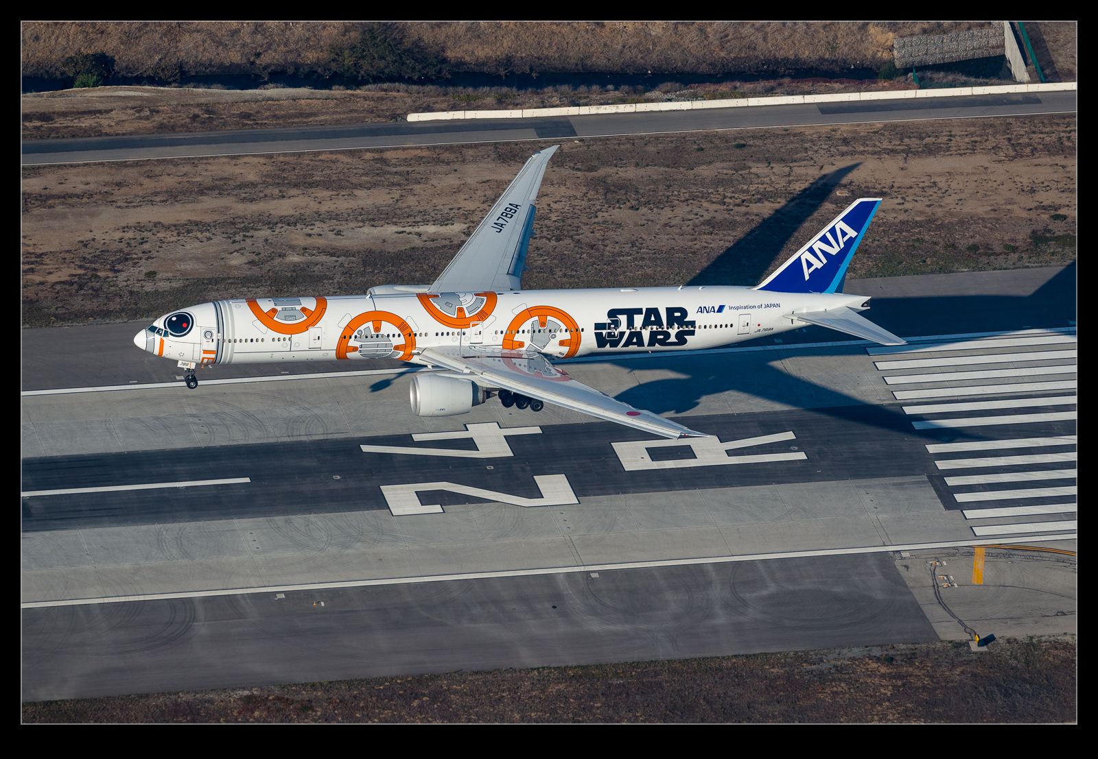
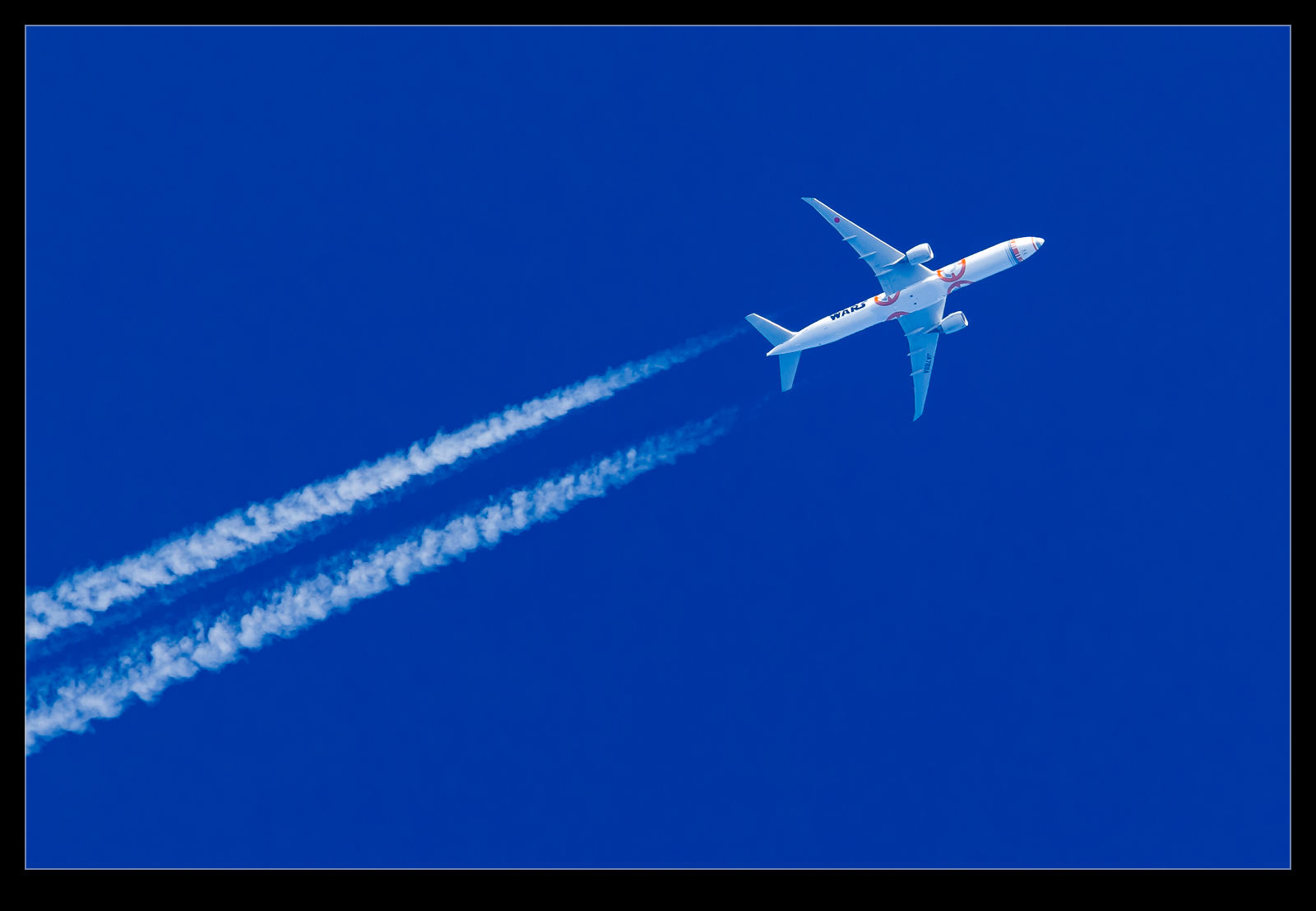
 Back when we lived in California, I saw the Star Wars 787 from All Nippon come in to San Jose. That is the topic of this blog post. There are a couple of other Star Wars planes that ANA painted up. One is a 767 and it tends to fly around Asia so I doubt I will get a chance to see it any time soon. The other was a 777-330ER painted up like BB-8. I few of my friends have seen it come in to Chicago but I had not seen it up close. They didn’t operate in to where I was. (I had shot it overflying me at high altitude once though.)
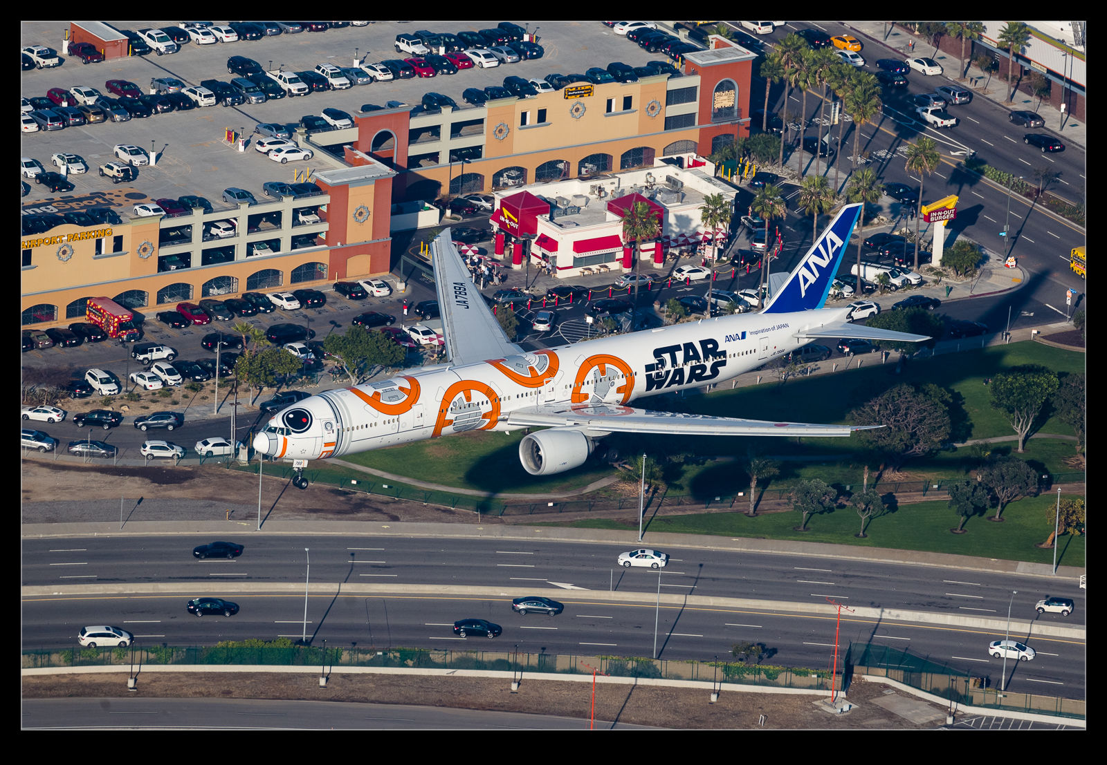
 Then I caught a break. I didn’t realize this at the time but it was operating to Los Angeles the day I was shooting over the airport. I knew an ANA 777 was on its way in but I had not paid too much attention to which aircraft it was. As I was hanging over the airport, I picked the jet out of the murky skies as it came down the approach and, as it got closer, I realized which jet it was. I have to admit, I was rather surprised and a bit excited when I saw it.