Tag Archives: travel

Emerald Bay

AE7I4147-Pano.jpg
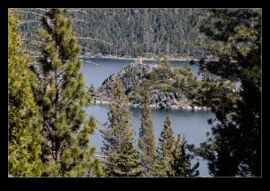
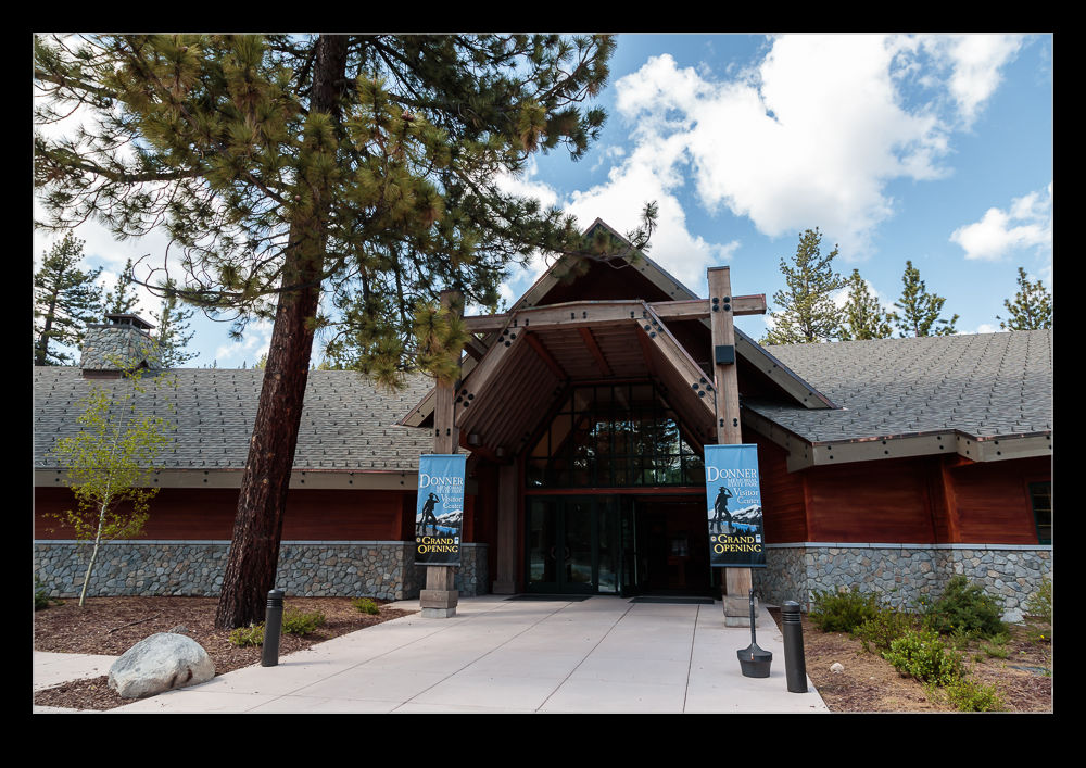
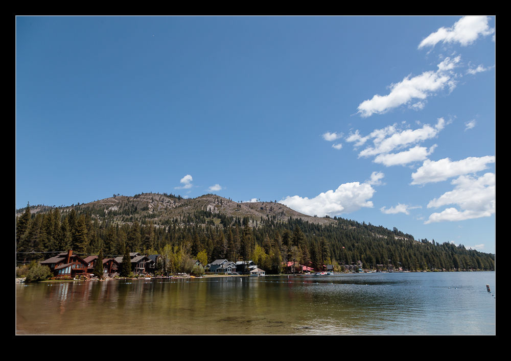
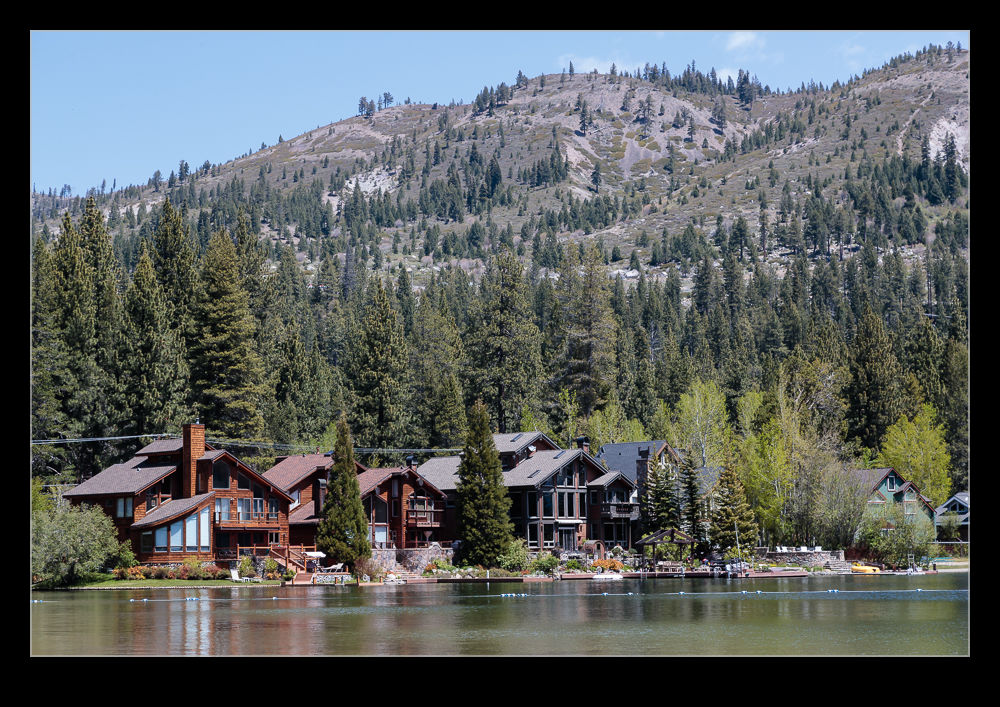
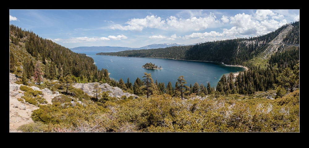
Lake Tahoe is a pretty place wherever you are on the shore (assuming you exclude the casino resort area on the south end).  It is easy to get blasé about the great views as you drive around the lake.  However, get to Emerald Bay and you will definitely notice the beauty of the place.  The highway winds around the bay high up on the hills so you have a view down to the water below you.  We approached from the south and there is a viewing overlook as you round the headland into the bay.  This was absolutely packed with people so stopping was not really an option.

AE7I4170.jpg
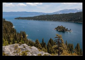
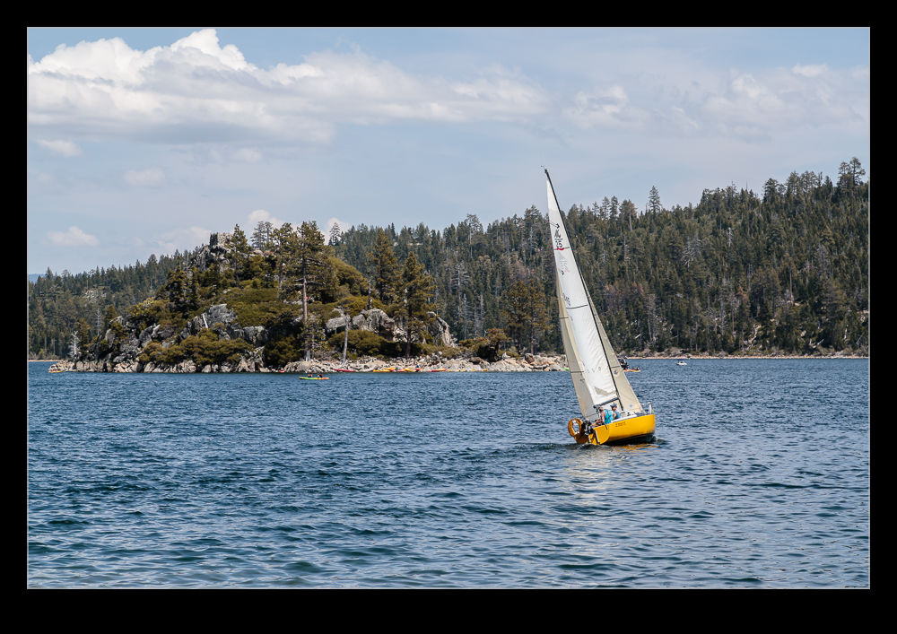
We continued down to the trailhead and got amazingly lucky to find a parking space opening up as we arrived.  People were parked all over the place and along the road in both directions but we were exactly where we wanted to be!  Outstanding!  The view down to the bay is lovely.  There is a small island in the middle of the bay which makes it look evening more inviting.  The idea of staying on the shore, swimming out in the bay and across to the island sounds great.  Of course, this is snow run-off so I imagine the water temperature as a bit on the chilly side.

AE7I4261.jpg
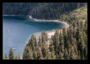
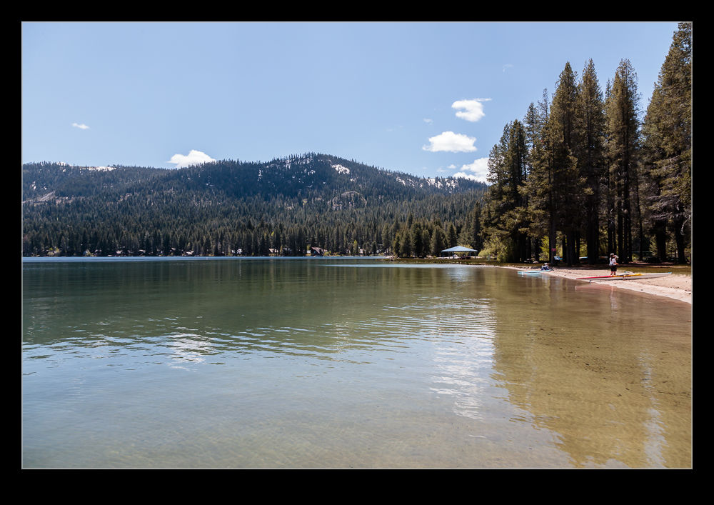
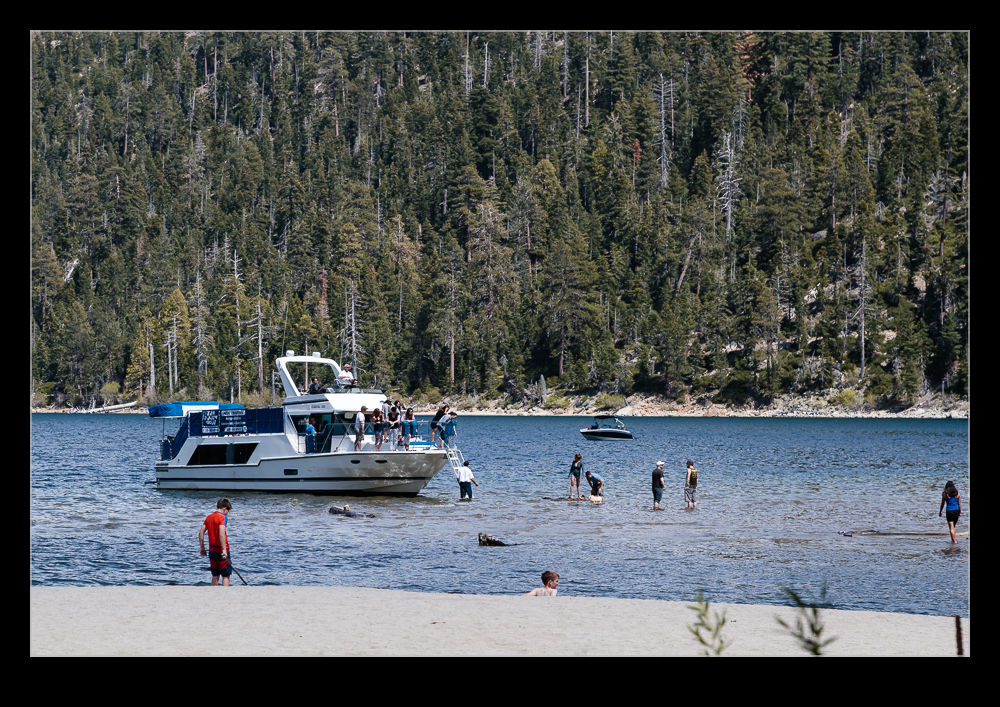
The place was hugely popular.  Not only were people on the beaches along the shore but there was a steady stream of boats pulling in to the bay from elsewhere on Lake Tahoe.  I have no idea how busy this place gets in the summer but I imagine it is absolutely crazy.

Donner Party Memorial

AE7I4014.jpgOf course, Donner Pass and Donner Lake are named for the Donner Party.  If you are not familiar with American history, this was a group heading west that got trapped in the pass in winter and many did not make it out alive.  Those that survived had to do some harsh things to make it.  The tale is a sad one and there is a memorial to the party near one end of the lake at the location in which they camped.  There is a visitors’ center and a number of trails.  The focal point is a large memorial.  The base of the memorial is as high as the snow was reportedly deep that winter.  It is a lot of snow!  On top is a group of hardy travelers.  When you think what people went through to get across the country in those days, they were truly hardy types.

AE7I4013.jpg

Donner Lake

AE7I3932.jpgI posted photos of Donner Lake a while back as I was traversing the Sierras en route to Reno.  This time we got a lot longer to look around.  We did stop at the overlook on the interstate but then we dropped down the hill to the lake itself.  There was a nice beach at one end which had a few people visiting even though it was rather early in the year.  Some of the houses built along the lake looked pretty nice too.  I imagine they would be very pleasant places to spend some relaxing time.

AE7I3928.jpg AE7I3947.jpg

Squaw Valley Olympic Village

AE7I4302.jpgSki resorts are designed around the winter season and, come the summer, they can often be rather deserted.  The weather was warm and sunny during our visit to Squaw Valley Olympic Village but the place was far from quiet.  There was a festival underway so the center of the resort was filled with stalls from various vendors selling all sorts of things but mainly focused on art and craft type items.  Meanwhile, bands were playing at a couple of stages.

AE7I4306.jpgThe event was obviously very popular and large numbers of people were milling about.  Some of the lifts up the mountains were also still in use.  Obviously a lot has changed since the days of the Winter Olympics in the 60s but there are still signs around the town of the history of the games having been there.  I imagine the winter games were a lot lower key in those days but I still imagine the valley was pretty busy at that time.  It would have been quite an influx of people.  I wonder what the evening entertainment was like then.

AE7I4318.jpg

Truckee

AE7I3952.jpgPrior to visiting Truckee, I knew virtually nothing about it.  I knew some people who had visited and liked it but I knew not much at all other than that it was a station on the railroad over the Sierras.  It turns out to be a great little town.  The main street provides a lot to see and do on a day out.  The variety of buildings is interesting and there is a nice map you can pick up at the visitors’ center that explains the history of various places and the background to the town itself.  It has gone through a number of phases as the economy of the area has developed.

AE7I3994.jpgThe Truckee Hotel looks very cool.  A colleague of mine stayed there a couple of years ago and had a great time.  A gas station has been restored and used as office space but it looks just like an operational gas station still.  The train depot includes the visitors’ center along with the Amtrak station.  There are plenty of places to eat and a good selection of shops with arts, crafts and other items.  We walked the length of the town and checked out the various buildings.  The street runs alongside the river and there is some more on the other side although not as much to attract your attention.  The town is not all though.  There is more in the vicinity for another post.  This would not be our only visit to the town on this trip either.

AE7I4001.jpg

San Luis Obispo

AU0E2405.jpgWe took a short trip to San Luis Obispo while staying in Paso Robles.  I didn’t know what to expect of the town other than that it is rated the happiest town in America (or some similar “statistic”).  We got a map of the town from the visitor center and the first stop off was the mission.  California is not short of mission buildings and I was expecting something similar to most.  I was pretty surprised to discover that it was a pretty large area.  The grounds were nicely landscaped and the buildings were extensive.  It was far bigger than I had expected.  I guess this was an important mission in its day.

AU0E2433.jpgA short distance away was the town museum.  Originally a library funded under the program Andrew Carnegie created for providing libraries across the country, the library moved many years ago to a larger facility.  After some debate, the building was re-purposed as a museum.  It was a pretty interesting little place.  My mum works with a local heritage organization in her town and I couldn’t help but imagine this place experiencing the same things she goes through on a regular basis.  We took a look around, made our donation and headed out.

AU0E2428.jpgThe town center itself is pretty vibrant.  We started out in an area that was mainly populated by individual businesses.  The whole thing felt very interesting and different.  I was impressed.  As we walked on, we came to the area that had all of the familiar chains.  You knew that they couldn’t be far away.  It did seem that the town had managed to avoid the homogeneity of many other towns though.  It also had a river running through the heart of the area.  Much effort had gone into designing nice pathways along the river and encouraging people to use it.  This is a big improvement on so many small rivers in towns which seem like glorified drainage ditches.

It seems like a nice place to visit and something that would have enough to encourage me to return.

Malham Cove

Scan 2-183.jpgI can’t remember how the conversation developed the way it did but I was talking with a friend and got on to the subject of Malham Cove.  Located in Yorkshire in the UK, this is a stunning location.  It is a horseshoe shaped rock formation that once was an impressive waterfall.  The water is still there but now the majority of the rock face is dry and it provides a great place for a hike.  To illustrate this post, I am digging back in to the archives in a big way.  This involves a trip I took there with an old friend of mine.  I will not give his name but I will be interested to see if he reads this and what he thinks of photos of himself from twenty years ago!

Scan 2-190.jpgYou can park your car in Malham and walk straight up to the cove.  However, we took an alternative route to make for a more interesting walk.  We walked up a narrow valley named Gordale Scar.  The valley gets narrower and narrower until you come to a waterfall.  Provided the water is not flowing too hard, it is possible to climb up the side of the waterfall.  Once at the top, you continue on a steady climb alongside a river – Gordale Beck.  Even as young and energetic fellows like we were in those days, I recall this being a pretty hard slog and, while neither of us was going to show weakness to the other, I seem to recall a few stops to enjoy the scenery – nothing to do with catching our breath.

Scan 2-181.jpgThings gradually flatten out and you cross some fields to come to Malham Tarn, a moderately sized lake.  This is the turning point for the walk.  Now you head back towards Malham itself.  You end up coming across a limestone pavement to the tome of Malham Cove.  Here you will meet a bunch of people that have walked up the steps from the valley below.  Having made a far longer trek, you are tempted to be a little dismissive of these people taking the easy route but there are still a lot of steps so they have had to make some effort.

Scan 2-187.jpgThe view from the top is stunning.  The drop down is a long one – about 80m (240’) – and there are often climbers testing themselves against the rock faces.  The cracks in the limestone can be quite large as you step across and it is fun to imagine the whole thing being under rushing water.  The formation is about 300m wide so, while it might be busy, you probably won’t feel crowded.  When you have finally enjoyed the scenery enough, you can descend the steps at the side to head back into the village.  This still gives you a chance to appreciate the view back up at the cove as you head away.

This place is stunning, particularly on a lovely day.  If you live in the UK and have never been, try and get there.  If you don’t live in the UK, add this to your itinerary when you go.

Disused Water Mill

C59F3137.jpgAs we left the house at Chatsworth, we walked along the river that led back to where we had started our walk from. It is a pretty large river and has a strong flow including a cool weir. Shortly before we got back to the car, we came across an old mill house. I am not sure whether the river has realigned over time or whether there was a strong flow down from above that is no longer in place but there was once a working mill in this location.

C59F3141.jpgThe stone walls of the building are still in good shape. The roof and any other wooden elements have pretty much gone at this point. Inside the building you can still see some of the iron work and the remnants of the axle of the waterwheel. There are gaps in the walls that show where other parts of the building were once located. The entrances are closed off so it isn’t possible to get in to the building. The wildlife obviously finds a way in. A sheep was quietly using the walls as shelter while we were there.

C59F3128.jpg

Rock Garden

C59F3060.jpgPlenty of people have rock gardens. When you have a country estate, the scale of your thinking can change. A rock garden now turns in to something that is a little more grand than average with rocks that should really be classified as boulders. We were actually beginning to wrap up our visit to the gardens at Chatsworth when we came through the rock garden. This place would be phenomenal if you are a kid. So many places to climb on and jump across. The opportunities for bumps and bruises would be many but it would be so worth it.

C59F3056.jpg C59F3063.jpg


Boris Bus

C59F0545.jpgMy years living and working in London were spent when the Routemaster was still a regular feature. As we left, the time was coming when the fleet would be retired and subsequent visits involved a more conventional selection of buses to get around the capital. (As an aside, when visiting London, use the bus rather than the tube. You see so much more and feel a lot more part of the city.). The days of jumping on and off moving buses seemed to be over.

C59F0548.jpgOur recent visit gave me my first view of the new buses that Boris Johnson wanted to replace the Routemaster. I am not very swayed by populist nostalgia and, aside from being able to get on and off when you liked, I felt the Routemaster had a lot of shortcomings as a passenger. However, I was curious as to whether the replacement was good or not. Boris’s hatred of the articulated buses struck me as utter bollocks. Sadly, we didn’t take any routes that used them. We did see a lot of them though. Interestingly, the rear platform was often closed off when I saw them. I guess that is only open on certain routes or in certain areas? Maybe someone could fill me in on that. They look a little strange but I imagine you become accustomed to them quickly enough. It will be interesting to see whether they come to dominate or end up as a diversion that ultimately goes away.