The thing that attracted me to a stroll along the Snoqualmie Valley Trail was the presence of an old railway trestle bridge. Known as the Tokul Trestle, it seemed to be on a curve over a deep valley based on what I could see on Google Maps. What I didn’t know was how much you could see of it from either side. Only one way to find out I guess.
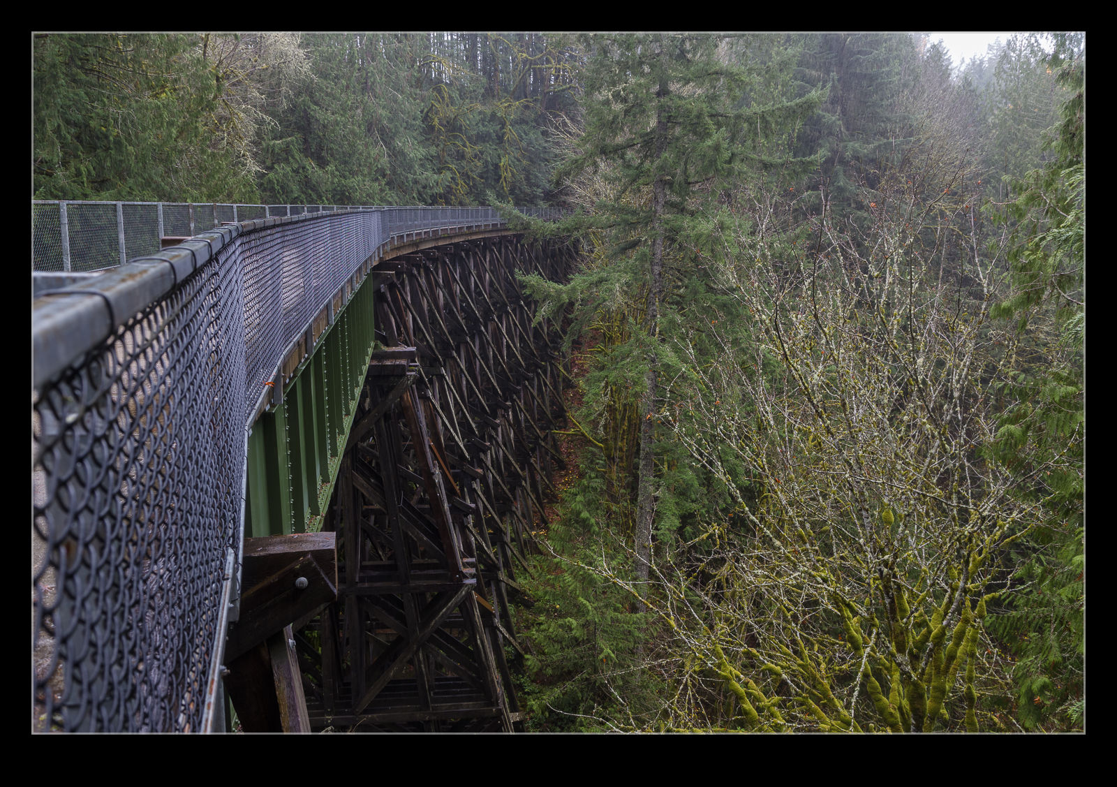 It wasn’t a terribly long walk from where I had parked the car to get to the trestle. When you don’t know a route, it always feels a bit longer but walking back seems a far shorter journey. Since the trestle was on a curve and the route was very tree lined, it was pretty much out of sight until I was nearly upon it. The majority of the trestle seems pretty old but there is a center section that seems to be more modern. Of course, that could have been there for ages and the whole bridge was maybe restored when the trail was being created. If I had done some research, I might have been able to tell you!
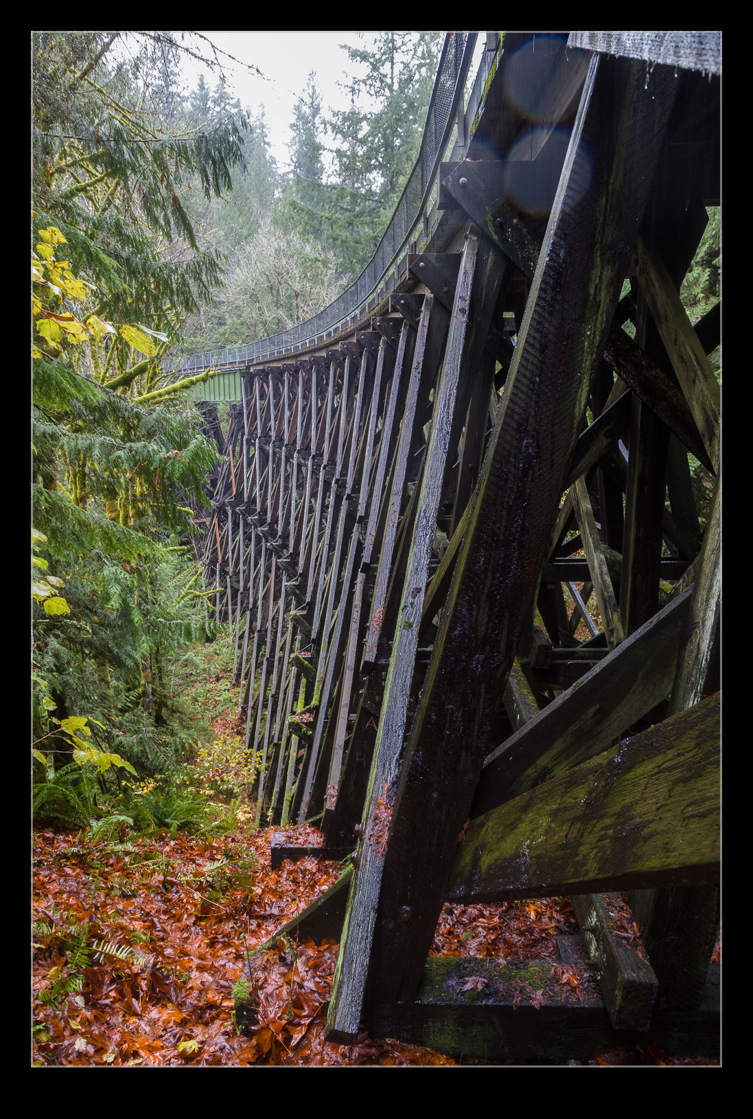 The curve of the bridge is quite gradual and, as I had wondered, the approaches are tree lined which makes getting too much of an angle on the bridge tricky. A drone would be a very handy thing for getting a broader view of the bridge or being down on the river bed below. Not sure who owns that but there is a firing range down there somewhere which I could hear along part of the walk. You can get down on the sides of the bridge at each end to get a bit more of a view of the structure and I did check that out. Since I was alone in an area without much cellphone reception, though, I didn’t get too adventurous.
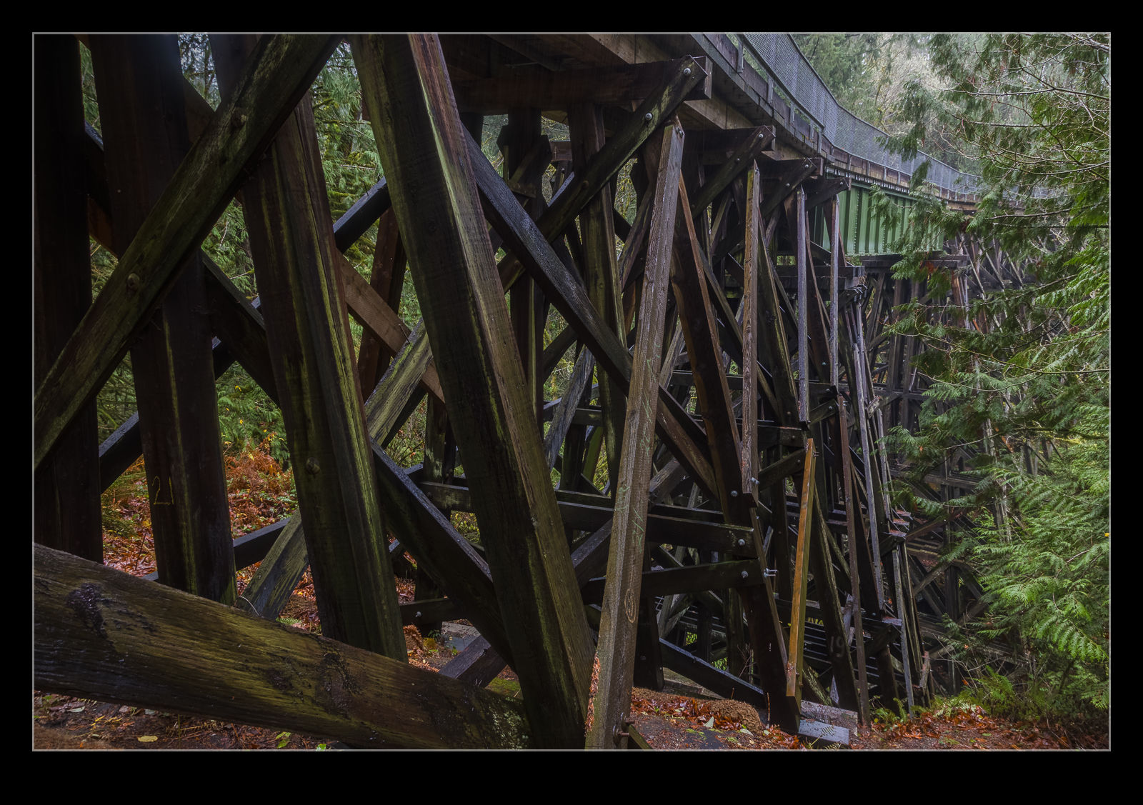 There is something about trestle bridges that really fascinates me. They seem quintessentially American to me. In the UK, rail bridges of old are either iron or brick. They look impressive too and make for great photo subjects. However, the trestle is something that evokes images of old steam locos crossing the country with wide flared smokestacks. The idea that they are still around and in good working order continues to surprise me.
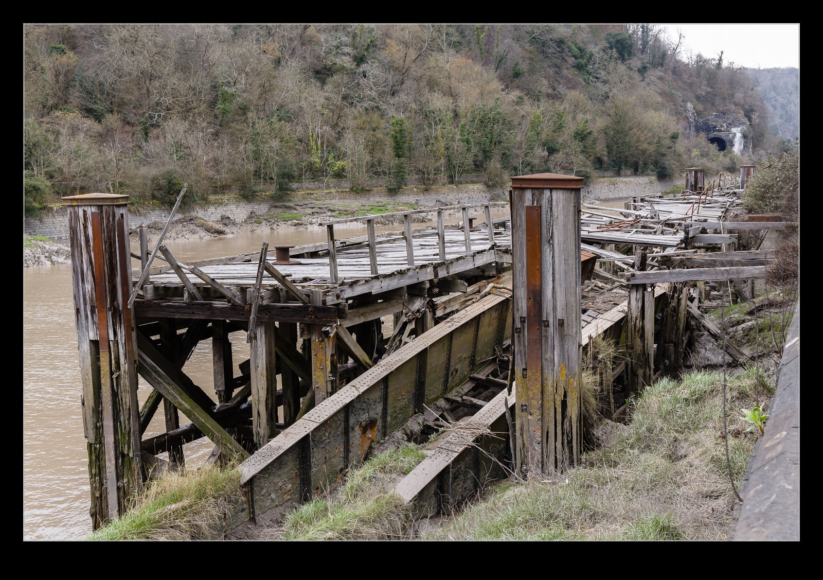
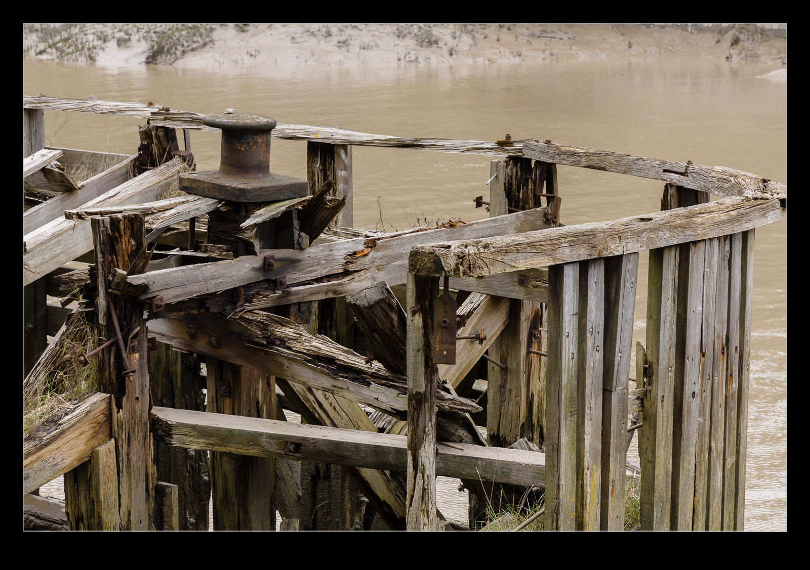
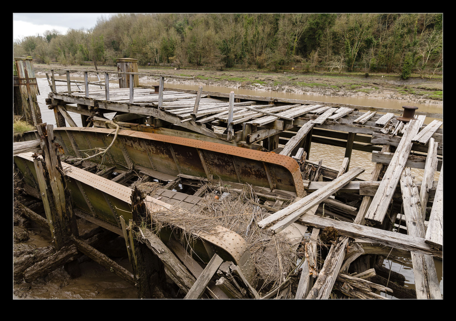 As you walk along the banks of the Avon heading towards the gorge, you are outside the locks that keep the water level up in the docks and in the tidal area. This used to be a popular location for boat to unload passengers and there are a number a jetties that have been built there. However, the traffic for these locations dried up a long time ago and they have fallen into disrepair over the years. The larger timber members are more resilient so you end up with these skeletal structures that are gradually collapsing. I wonder how many more years they shall survive or whether they will be deemed too dangerous and taken down before they can collapse.