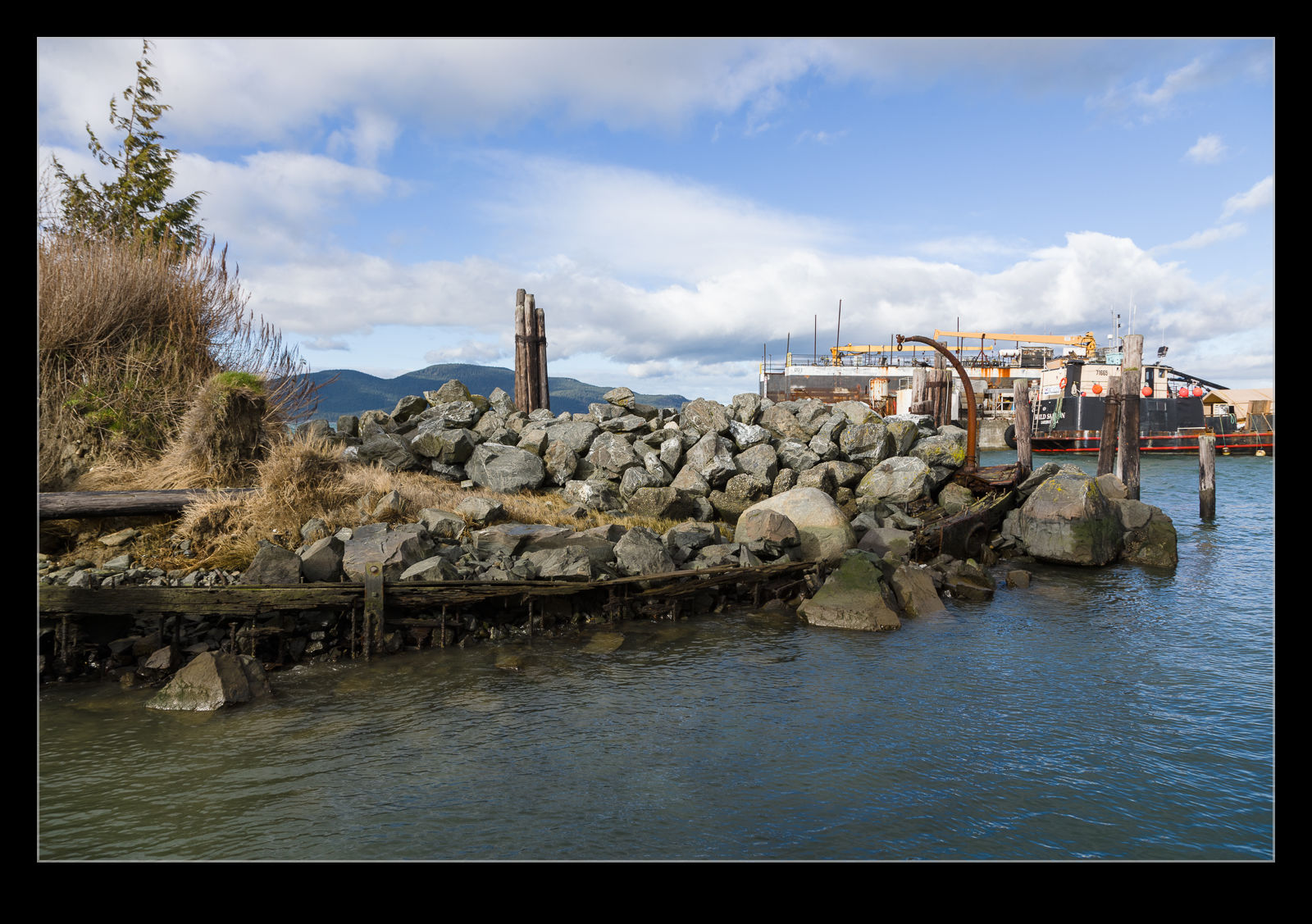
 In this previous post, I had some shots of a ship hull in Anacortes that had become part of a harbor wall. When I showed this to a colleague of mine, he looked at Google Maps and thought there might be one or two more hulls making up the harbor. Once I saw what he was looking at, I could see what he was thinking. I also couldn’t work out why I didn’t go down to take a closer look when I had been there. A return journey seemed in order.
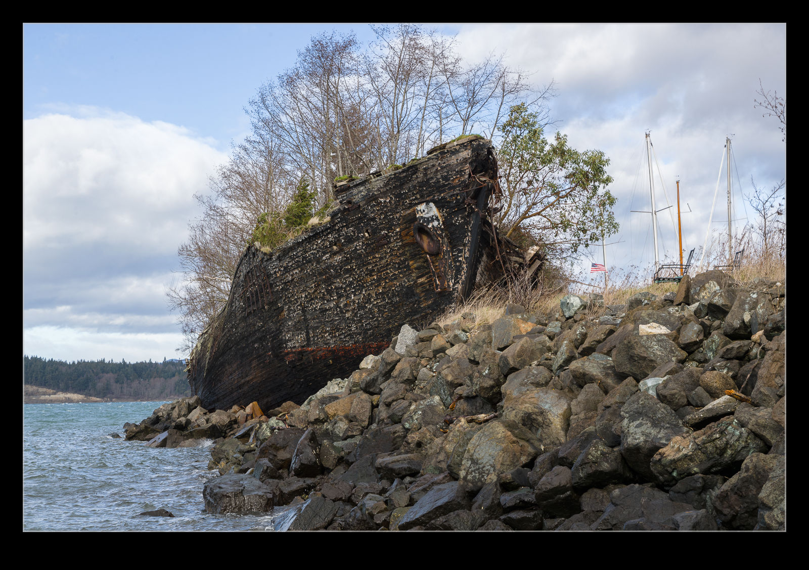
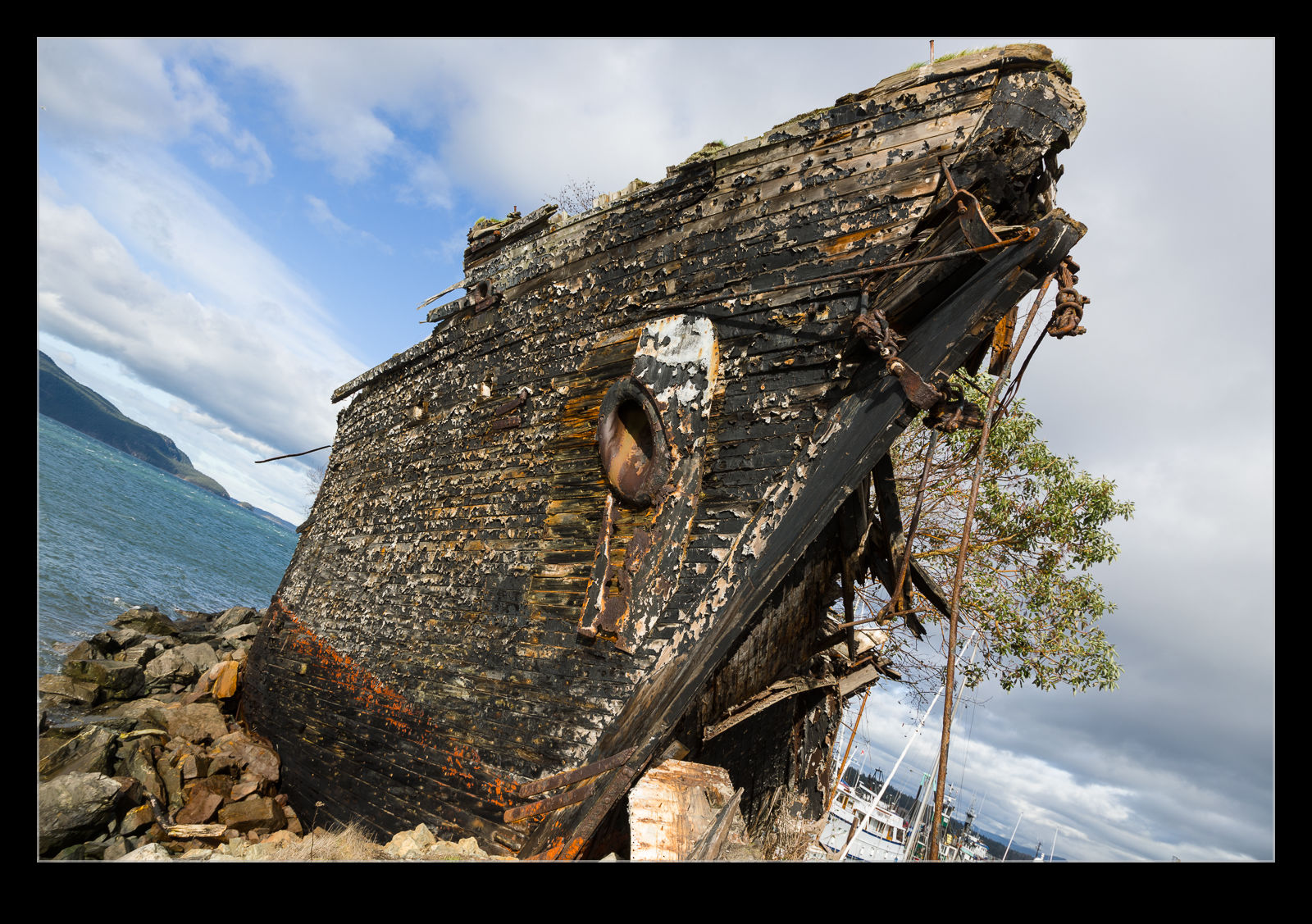
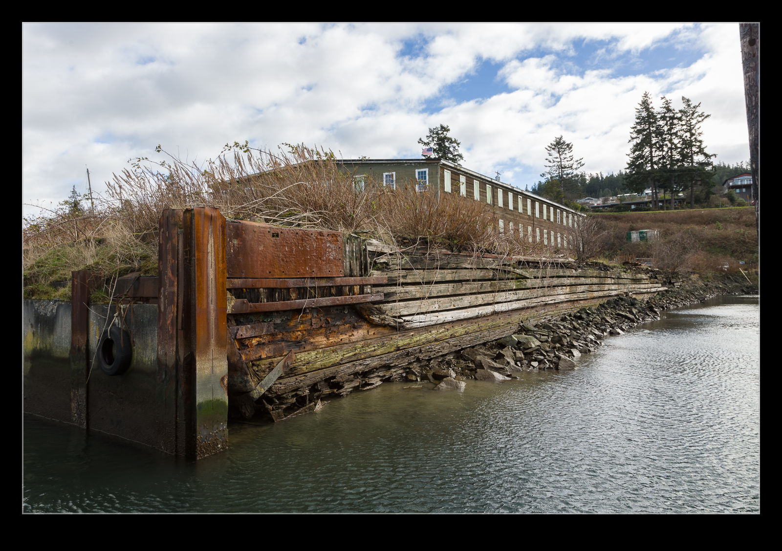
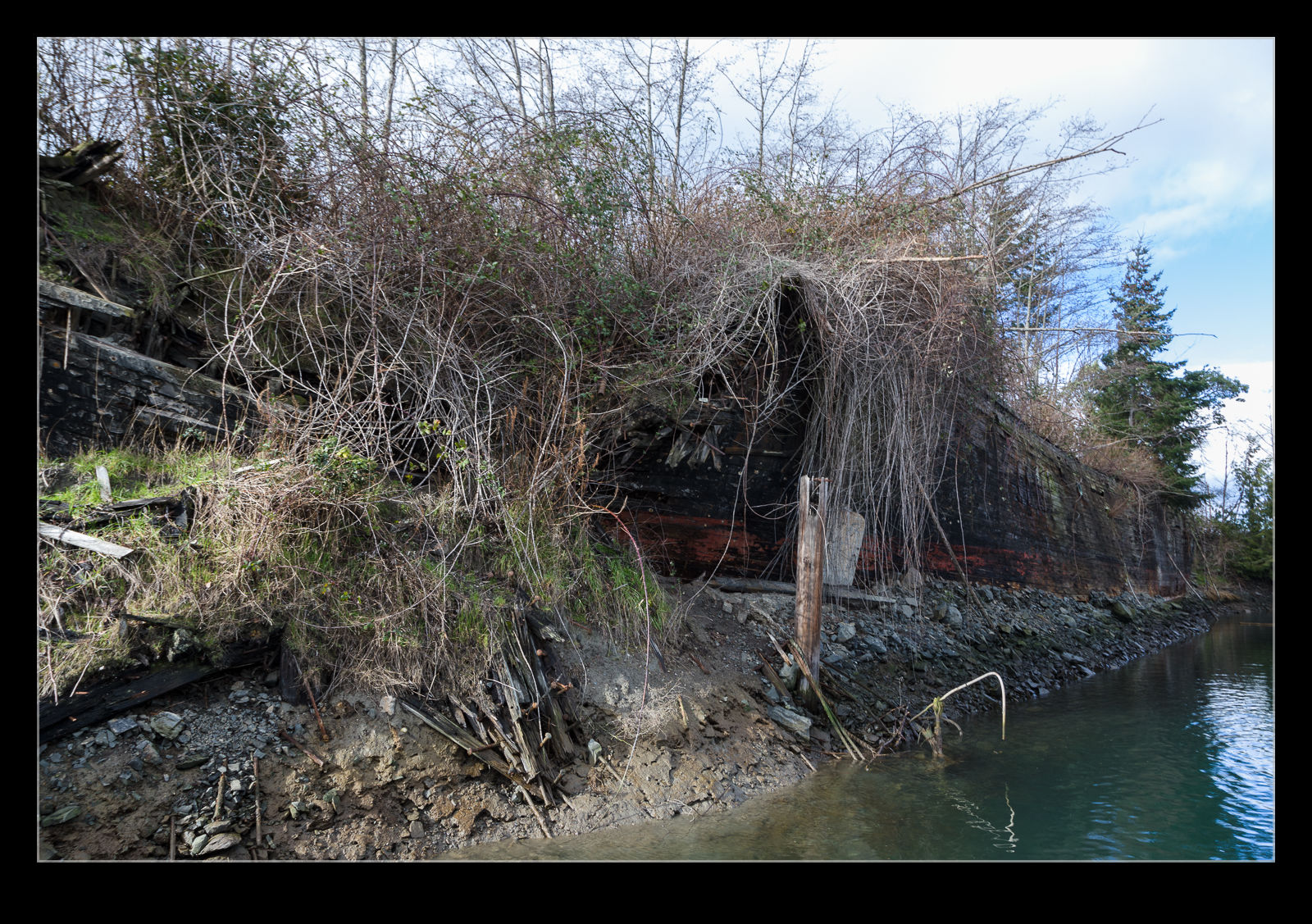 First I checked out the original hull and the one that is in the best condition. It looked more impressive when down on its level. I didn’t see any sign of a name which was a shame. Then I went to see what the other areas were. Sure enough, behind the first hull is a second one. This one is much more broken down but the timbers are still there making up another part of the harbor wall. I then realized that a third hull was part of the harbor which we hadn’t seen from Google. That is because it is a barge hull and so square which meant it wasn’t conspicuous from the aerial photos.
 The last hull was located within a shipyard and, since I didn’t have permission to enter their premises, I didn’t go closer to check it out. A look from the access road above it did seem to confirm that it was indeed another hull. I guess whoever created the harbor figured the easiest way to do so was to sink a few derelict hulls and then build up the land around them (or let nature do that for you). I imagine that has been done elsewhere. Not quite the D-Day Mulberries but something similar.