My sister has pretty amazing eyesight. Her ability to spot things before the rest of us has shown itself on many occasions. I have often been wondering if she is just making things up only to finally see what she saw. To all my pilot friends, I would recommend her as a second pair of eyes anytime.
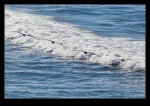
We were taking a trip along the Pacific coast while they were over visiting recently and she said she had seen a whale. This is by no means unusual along this stretch of coast but, even so, I was a little unsure if it really was a whale. Turns out it wasn’t a whale. It was at least five of them. They were a little way offshore but there they were. Plenty of spouts of spray from blowholes and the occasional sighting of bodies as they came to the surface. It was a shame that they were so far out but at least they got some whales for their visit.
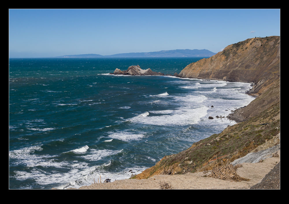
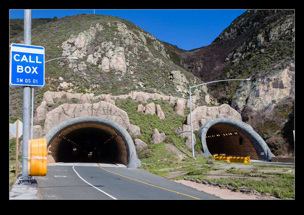
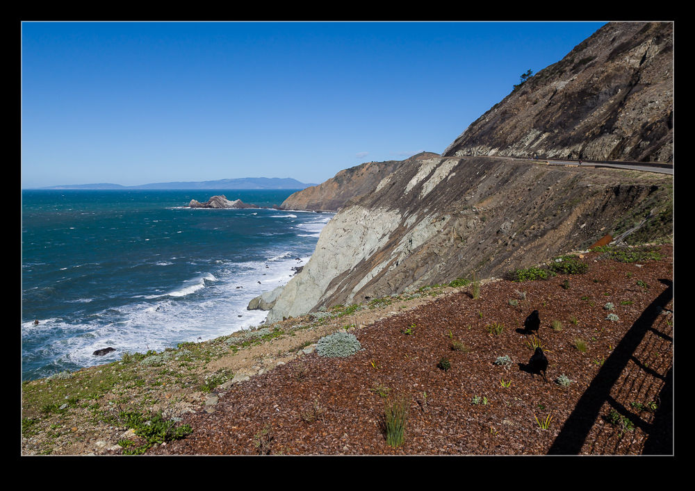
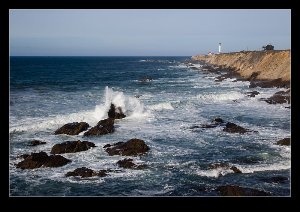
Shortly before we moved to California, a change was made to the route of Highway 1 along the Pacific coast. Many stretches of the Pacific Coast Highway run along the tops of cliffs. One section south of Pacifica was very prone to landslides with regular disruption to the accessibility. After many years of debate, the decision was made to create a twin bore tunnel for the highway to bypass the troublesome area without impacting on the surrounding area.
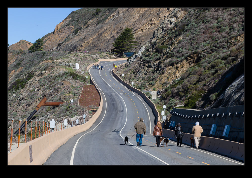
The surplus highway was not abandoned though. Once closed, work was started to convert it into a trail for walkers and bikers. This was opened not long after we arrived. Ever since reading about it, I had been thinking of checking it out and, on our way home from a weekend down in Half a Moon Bay, we stopped to see what it was like.
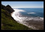
The whole thing is probably 1.5 miles in length. It certainly includes some pretty steep slopes considering that this was once a highway. The views over the cliffs to the ocean below are stunning. You are pretty exposed though. On the day we were there, there was quite a strong wind. Sections of the trail are a little sheltered so you don’t notice the wind. Others, though, are in the teeth of the wind. One area has a cutting between a rocky peak and the cliff face. The wind really accelerates through here and we were working hard to keep on our feet!
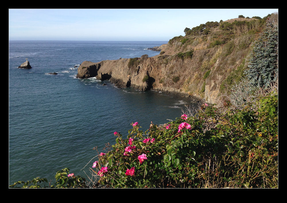
Supposedly you can get migrating whales coming very close in shore at this location. I would certainly want to go back to see if we can some whales. The high angle would certainly make it easier to spot them compared to the normal effort picking out the clouds of spray when they exhale. I will be interested to see how busy it can get. It was not too popular when we were there but maybe the timing was not good for many people.
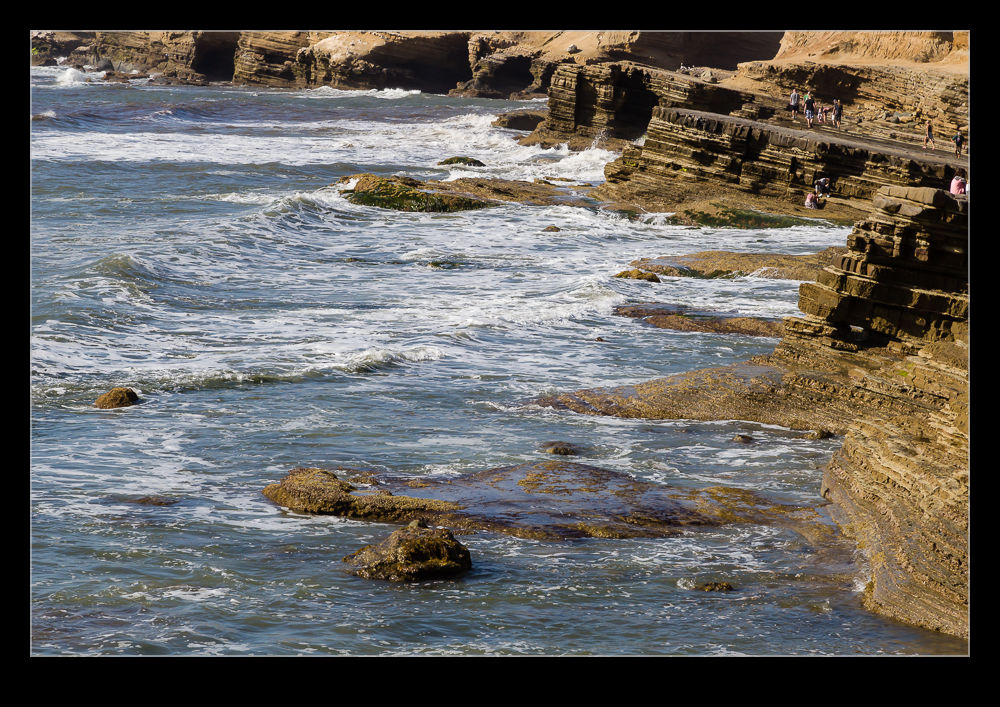
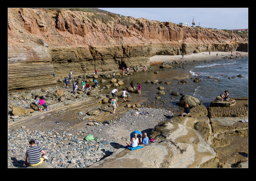
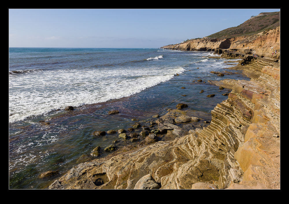
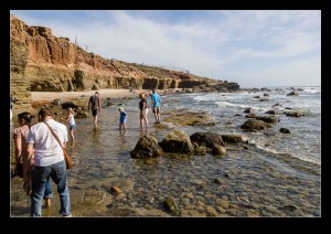
I have been to San Diego a few times but one area I had never explored before was Cabrillo National Monument. Head out through Point Loma to the end of the peninsula and you enter the national park area. It was getting towards the end of the day when we got there so the visit was a little truncated. First we went to the tide pools. The signs said they would be closing first, hence the decision.
Of course, why would the tide pools be closing first? Because the tide was coming in. By the time we got there, the water was already starting to get close to coming over the rocks. Nevertheless, there was still a chance to have a quick wander around by the water. What was probably nicer was the view along the shore. The trails along the cliff tops provided great views of the ocean and the coast off into the distance. If we had been there earlier in the day and had more time, this would have definitely been a place to explore further.
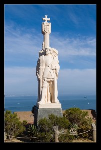
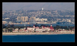
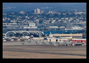
We then headed back up to the top of the ridge and the visitor center. Here is the statue of Cabrillo himself as well as a great view across the whole of San Diego. With Coronado Island in the foreground including NAS North Island and the Hotel Del Coronado and then San Diego’s city center rising behind it, the whole bay area looked great in the gradually lowering evening light. Of course, the late arrival did mean that we were coming up on closing time so it wasn’t long before they announced it was time to go.
It’s not like we have a ton of bad weather here but, with a forecast for a nice weekend, we decided a trip to Point Reyes would be a good plan. An early start combined with a stop for breakfast in Larkspur and we were on our way. Even the drive to Point Reyes is nice so you really feel like you are having a good day out in the prettiest of countryside. This time of year is a popular one because of the wildlife. A previous trip was one during whale migration season. The lighthouse is a good spot for watching the whales but the parking lot is not up to the task. At times like this, they close off the road and run a bus shuttle from Drake’s Bay.
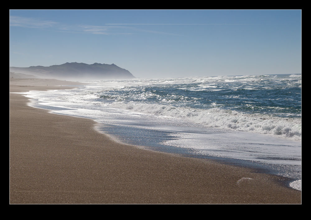
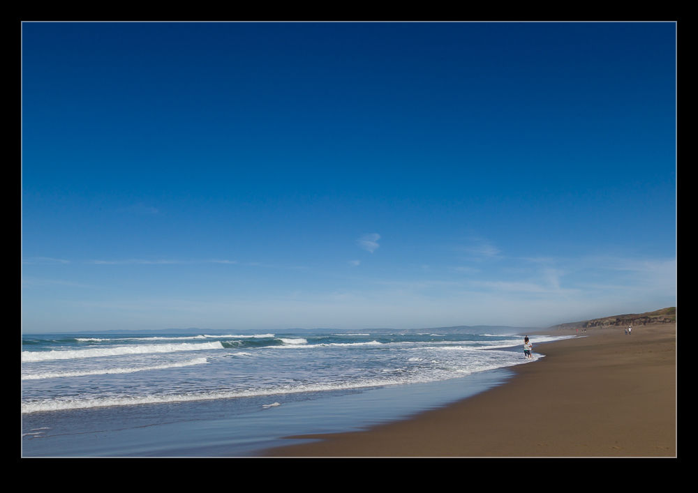
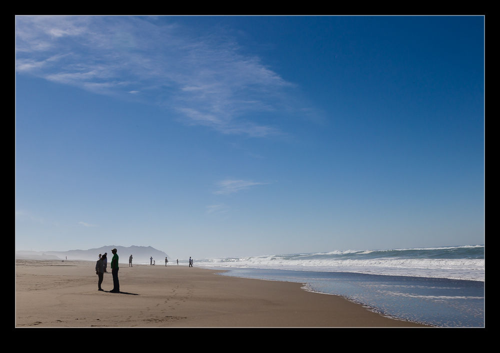
This was not whale time. However, the shuttle was in operation again. This time it was because the elephant seals were on the beaches and lots of people were coming to see them. We were less bothered about going to the normal places and, instead, wanted to enjoy the shoreline. On previous trips to the lighthouse, I have looked down on the beaches to the north and thought how great they look. Not only are the picturesque but the ocean swell results in some great waves running ashore. This time it was time to see them up close.
The beaches were surprisingly quiet. There were quite a few people there but a combination of the large expanse of beach and the desire of many people to not stray too far from the parking lot meant that a short stroll got you a stretch of beach to yourself. Indeed as we walked up we were creating the first footprints in some areas. (When we left, the trails of prints had multiplied!)
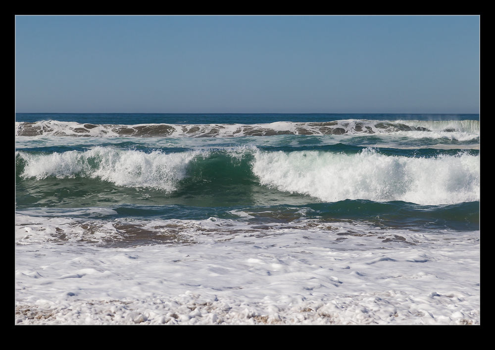
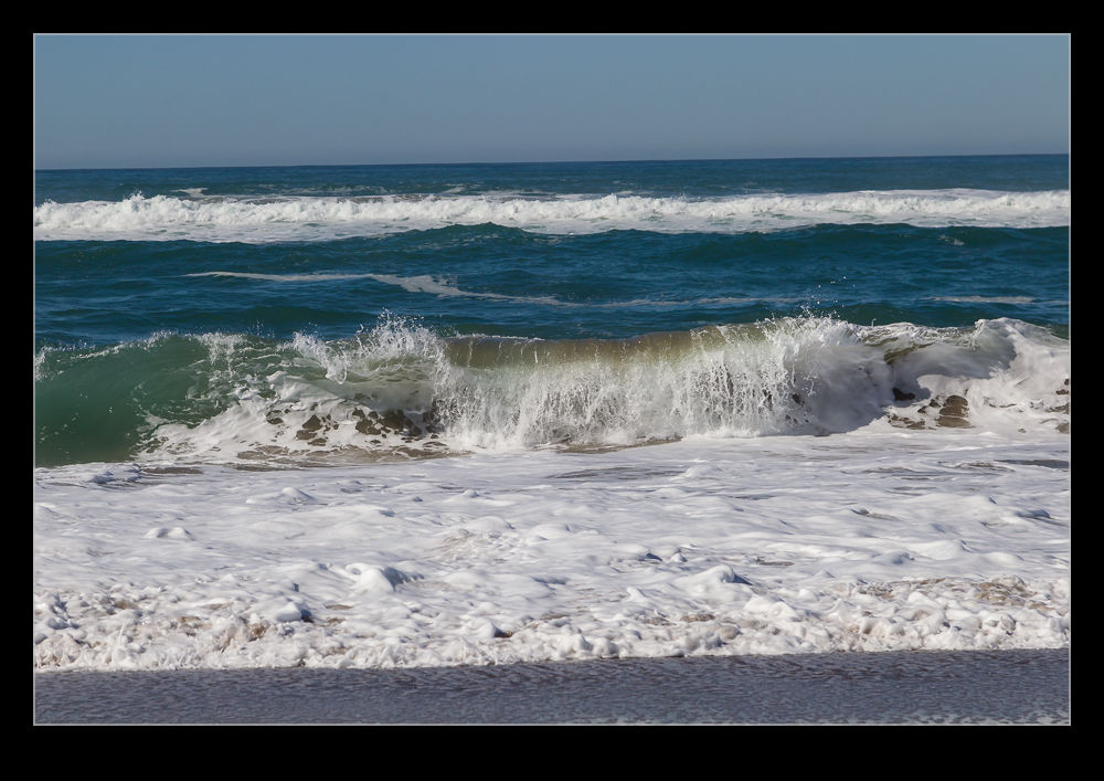
Walking along the water’s edge is the easiest thing to do since the sand is firmest where it is wettest. Of course, that does require paying attention to the larger waves which occasionally run a lot further up the sand than you expect. As long as you don’t mind a little embarrassment, a quick sprint out of the way usually takes care of things!
We found a particularly quiet ridge just above the water line and sat down for a while. The waves were very soothing despite their strength and sitting on the sand, under the sun as the surf rolled in was as close to perfect as you could wish for. I have no idea how long we stayed there. It was quite a long time but I could have stayed forever. We did have to go eventually of course but it was a wonderful way to spend a day. I did shoot a little video of some of the waves just to remind myself. Here is a little of the wave action if you want to have your own beachside moment.
Sometimes it is hard to remember that there are places as pretty as Half Moon Bay within an hour of where we live. If the traffic is flowing, it really is a short trip to get there. I have been there a few times recently for various different reasons. While we had relatives visiting, I thought a day trip there would be a good idea. The weather was looking nice (which it hadn’t been for much of their visit) so getting to hang out near the ocean was worthwhile.
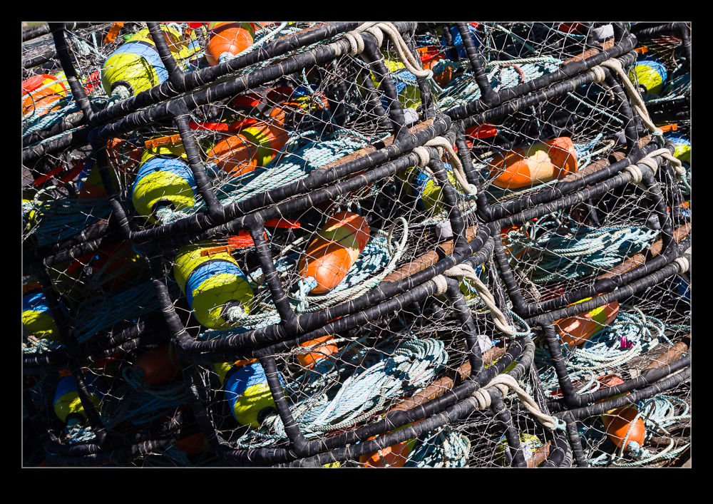
The harbor at the north end of the bay is a nice place to be. Aside from some nice refreshments at a café near the harbor, there is the shoreline to wander along. It is also a launching site for local fishermen and some of the crab pots were stacked up along the parking lot. They are colorful despite their functionality.
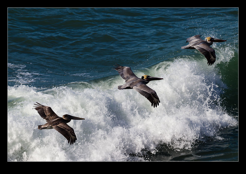
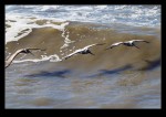
A short drive north of the harbor is a favorite spot of mine. It is a parking lot at the top of some cliffs. The parking lot is for a distillery that I have never visited. Whisky is not really my thing. However, the view over the ocean with the waves crashing in below combined with the wildlife that lives along the coast makes it a relaxing place to be. We had pelicans flying low along the surf and seals that seemed to be hanging out in the shallows. Not sure why they were there but I suspect it was easy to rest there out of the way of the sharks further out in the deeper water. We even got a squadron of pelicans running along the ridge near us just before we left. It was like I had booked them.
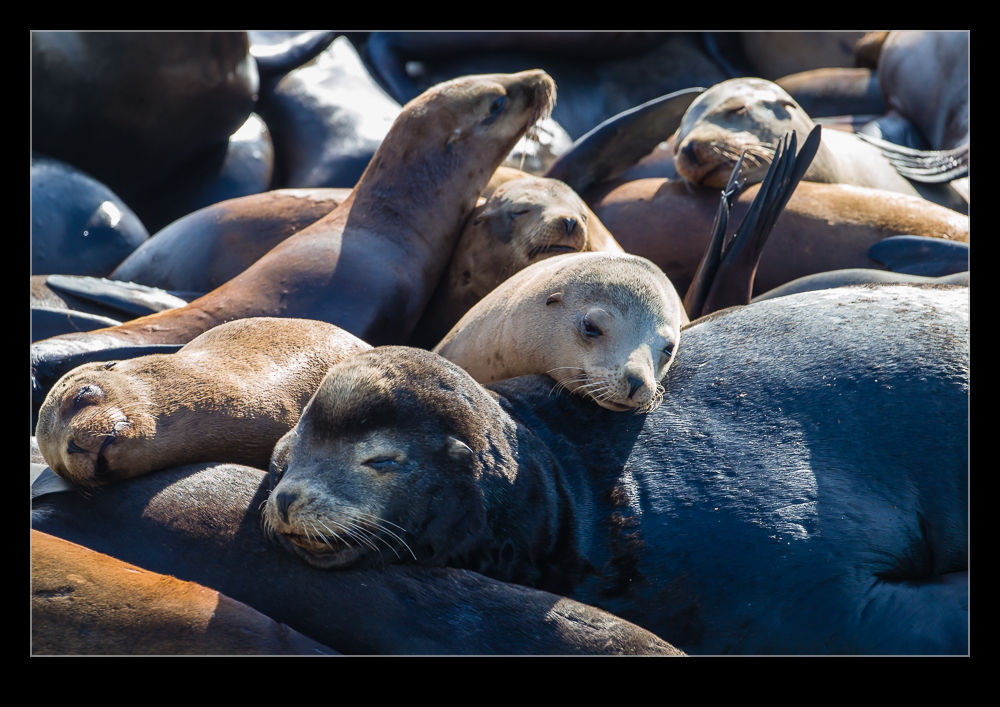
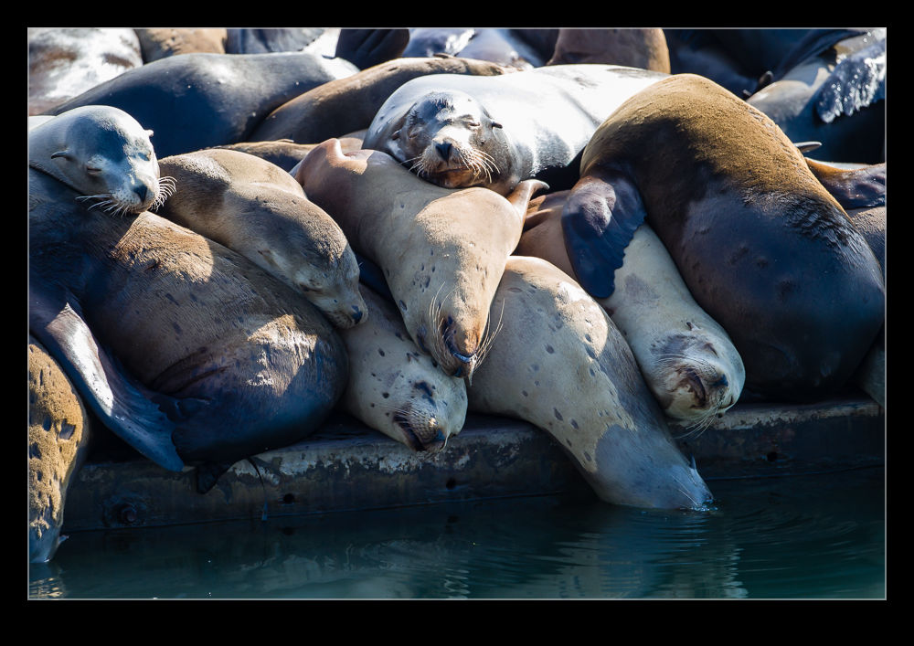
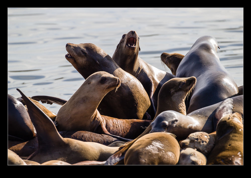
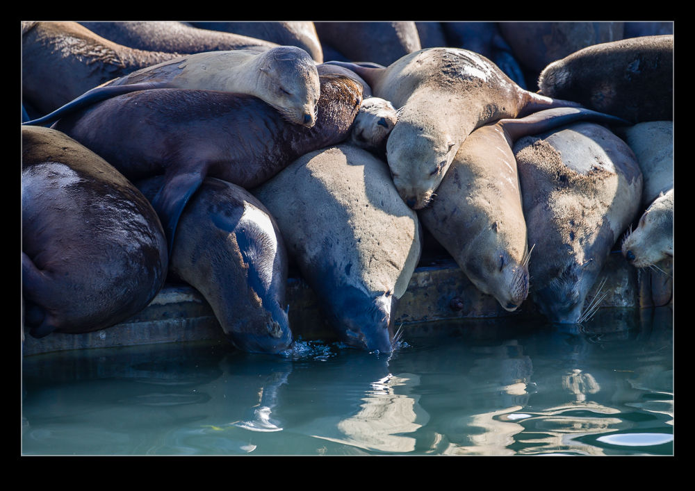
Relaxing with our lunch near the harbor entrance at Moss Landing, the noisiest thing we could hear (apart from the foghorn on the entrance markers) was the sound of sea lions. There was a steady stream of their barking so we were looking around to see where they were. There was a pontoon jetty near the highway that was the source of the noise with a lot of them lying on it and sunbathing. We figured this had to be worth a visit before we left.
A while later we drove around to the location of the jetty and took a look at the gathering. This was not just a few sea lions. There were tons of them. There was nowhere near enough space for them all so they were piled up on top of each other. It was quite a sight. Several deep they were stacked across the dock. As new ones would leap out of the water, they would land on those already there and try to make their way to their preferred spot. All of this would arouse the ire of whoever they were walking on so barks and bites would be thrown around with abandon. It seemed quite a perilous voyage. Getting out at all wasn’t easy since there was no space to gain any purchase initially so, if the first leap wasn’t good enough, the chances were you would be “helped” back into the water.
It was hard to work out where the preferable location was. It appeared that the water’s edge was better since the sea lions there would periodically drop their heads into the water to cool off and blow some bubbles. We guessed that made this the best place to be but it was hard to tell. Some of the others on the edge were almost totally buried by their neighbors and that didn’t look to appealing. Whichever way it works, it was obviously the place to be if you were a local sea lion.
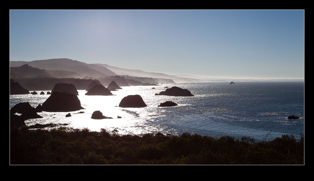
Returning from Mendocino County provided the option of driving along the coast heading south. The Pacific Coast Highway is a great choice if you have time on your hands and we did have. Therefore, we headed this way. The run down the coast is a combination of great views, long runs along the cliffs and the occasional area of twisting road around the inlets that occasionally cut into the shoreline. When the road is quiet it is a lot of fun. If you get stuck behind a bunch of RVs, it suddenly is a little less enjoyable.
We stopped a number of times en route to enjoy the view. One diversion out towards a lighthouse provided a lovely overlook of the shore including a bay below us that was full of sea lions. Despite the crashing waves, this area apparently provided a bit of shelter and the sea lions were seemingly taking it easy behind the protection of some rocky ledges.
There are lots of areas with large rocks slightly offshore. This reminded me a lot of the coast of Oregon (which, since we weren’t that far south, is probably not that surprising). Heading south we were looking into the sun so had some lovely reflections of the light off the water. Occasionally the edge of the road was very close to the top of the cliffs so you do have to stay focused as you drive along but it is a beautiful area on a sunny day. I imagine if a storm is rolling in from the ocean, it is also dramatic but a little less welcoming.
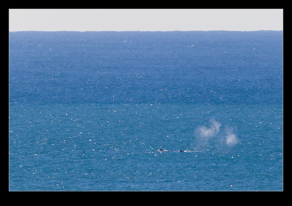 My sister has pretty amazing eyesight. Her ability to spot things before the rest of us has shown itself on many occasions. I have often been wondering if she is just making things up only to finally see what she saw. To all my pilot friends, I would recommend her as a second pair of eyes anytime.
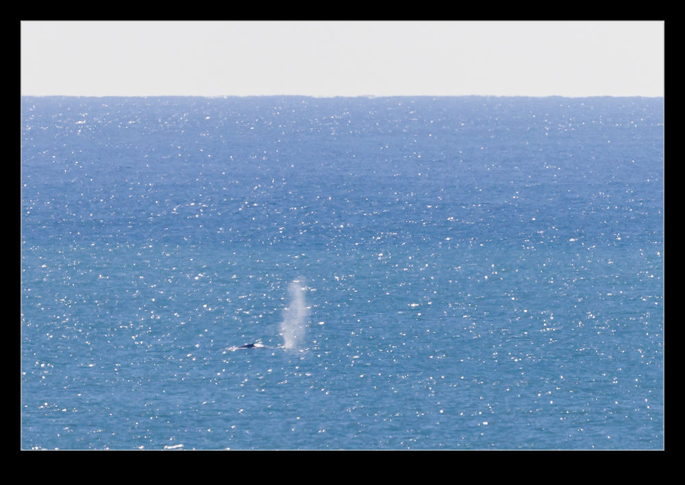 We were taking a trip along the Pacific coast while they were over visiting recently and she said she had seen a whale. This is by no means unusual along this stretch of coast but, even so, I was a little unsure if it really was a whale. Turns out it wasn’t a whale. It was at least five of them. They were a little way offshore but there they were. Plenty of spouts of spray from blowholes and the occasional sighting of bodies as they came to the surface. It was a shame that they were so far out but at least they got some whales for their visit.